The Via Valais – trail running from Verbier to Zermatt
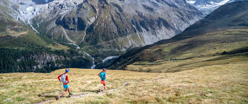
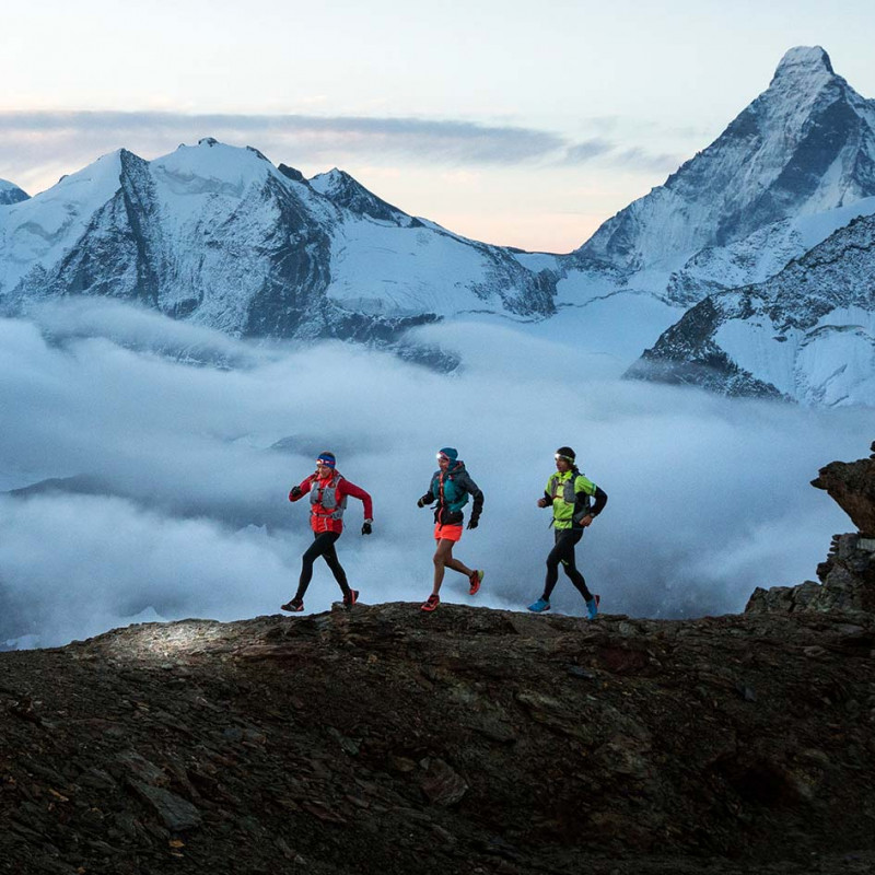
225 kilometers and 14,000 meters of climbing through the Valais Alps: Via Valais ties together both legendary Swiss mountain villages of Verbier and Zermatt. The course is divided into nine stages. An average of 24 kilometers must be covered each day. At first, that doesn’t sound like so much – but this route will throw it all at you. The terrain is technically very challenging and, of course, as the days progress you’ll have more and more distance in your legs. If that isn’t enough, you also have the opportunity to take on a “bonus peak” on every stage.
Overview of the Via Valais
Hikers have the Tour of Mont Blanc. ski mountaineers have the Haute Route. But what’s out there for trail runners? Until now, there has been no stand-alone multi-day running route through the Alps. High time for that to change! Of course, you can simply run the TMB or the summer Haute Route, and there are plenty of people who do that too. But that’s not really what we have in mind. We want to create a new route – because Valais has so much more to offer than both of these two well-known routes. We would even go so far as to say that the best running routes in the world are in Valais. And that is precisely why we planned the Via Valais with its new and challenging stages.
As with the classic Haute Route, we wanted our tour to end in Zermatt. As a starting point, Verbier then seemed to be ideal because from here one has access to some of the best hiking trails in all of Valais. We didn’t want our route to simply go along the Haute Route. Our Via Valais was to be a completely independent route. We wanted it to lead along trails that were perfectly suited for running and would thrill with its spectacular backdrop and exciting, diverse terrain.
Here and there, this tour runs along some of the same sections or alternatives to the Haute Route. But it is in the process always designed so that it’s fun for us runners. While the Haute Route essentially on one end takes a direct line down into the valley and on the other takes you directly up again, the Via Valais is oriented to run along with the countryside’s natural terrain. Sometimes it goes up and over the valleys, sometimes it leads downward. At the same time, the Via Valais pushes along through higher Alpine terrain than the Haute Route ever does.
Optional peak bagging – a bonus for the highly motivated
Often, it is that little extra something that makes a good thing better. Extra hours, extra climbing, extra fatigue – that is what you get from our “bonus peaks.” Our route planner Janine always has one or another in mind before we take off. After we’ve been out for a few hours, then she adds as an aside that there is another possible summit for us to do. Or, she asks right out of nowhere, “Anybody interested in another small detour?”
Normally, we let out a short groan, but then we are ready to laugh and take it on. Even when your legs are already a bit tired, we learned one thing: The bonus peak and the effort are always worth it!
The route through Valais is in itself a big challenge. Along the route there are so many tempting peaks that we just simply couldn’t say “no” to. Thus, on every stage, we sought out another optional summit for the especially motivated. The terrain here is normally technically very demanding, and in some cases, you also have to do a little scrambling to get all the way to the top. Some peaks demand just a short detour and are more or less on the route. Some on the other hand are best tackled directly at sunrise and before you head out on the day’s actual stage. On the fifth day, for example, you head up to the Cabane de Moiry refuge on the Pigne de la Lé. After summiting you run back again to the hut to indulge in a second cup of coffee and to fuel up for the route to Zinal. We couldn’t help ourselves and even had to take on the detour across the Üssers Barrhorn on the seventh stage.
With its 3,610 meters, it is the highest mountain for hiking in Europe with a marked route all the way up. Our add-ons transform an already demanding day into a much longer one – but also make it that much more beautiful. Perhaps the most amazing bonus peak on the route is Mettlehorn (3,406 meters) on the final stage. At the Trift mountain hut, you can grab a delicious iced tea as fortification and then all you have left is the descent to Zermatt. If you haven’t had quite enough you can draw out the descent a little bit and instead climb the almost 1,100 meters of vert to Mettlehorn. From this spiny peak, you look directly onto the Matterhorn. You can then visually retrace the complete course and its route along the mountain chain across the various valleys from start to finish, directly under you.
If you do the bonus peak on each stage, the run would be a total of “only” 33.5 kilometers longer. But to that comes another hefty 4,199 meters of climbing.
Via Valais: Overview of the stages
Stage 1: Verbier to Cabane d’Essertze: 29k, 1119m+/1113m-
Stage 2: Cabane d‘Essertze to Cabane Aiguille Rouge: 30k, 1783m+/1178m-
Stage 3: Cabane Aiguille Rouge to Cabane Becs de Bosson: 25k, 2220m+/2052m-
Stage 4: Cabane Becs de Bosson to Cabane de Moiry : 17k, 868m+/1025m-
Stage 5: Cabane de Moiry to Zinal : 24k, 1064m+/2215m-
Stage 6: Zinal to Turtmann Hut: 19k, 1687m+/841m-
Stage 7: Turtmann Hut to Randa: 18k, 1376m+/2453m-
Stage 8: Randa to Mountain Lodge Ze Seewjinu: 25k, 2025m+/1171m-
Stage 9: Mountain Lodge Ze Seewjinu to Zermatt: 27k, 1254m+/1942m-
Via Valais: Stages in detail
STAGE 1: Verbier - Cabane d'Essertze
(29k, 1119m+ / 1113m-) The Via Valais starts in Verbier. You head up to Les Ruinettes with the gondola. We follow the first kilometers along Bisse de Levron. What is known as Bisses are ancient waterways, which with their soft surfaces are ideally suited for running. The Bisse de Levron is a classic where you can warmup well. As soon as you have the ski resort and the Col Termin and Col de Louvie behind you, it gets more and more wild.
STAGE 2: Cabane Essertze - Cabane Aiguille Rouge
Distance and vertical: 225k and 14,000+ meters of vert
Start / finish: Verbier 46 ° 05'28.3 "N 7 ° 15'09.4" E to Zermatt 46 ° 01'11.0 "N 7 ° 44'46.3" E
Requirement: Advanced / Alpine experience mandated
Safety-related aspects: The route does not demand any special equipment. Of course, trail running shoes, suitable clothing for changing weather conditions, and poles are advised. A high degree of conditioning and alpine experience as well navigational ability are also absolutely necessary. The route occasionally follows blue-and-white marked alpine tracks that cross technical terrain with exposed areas where sure-footedness is required. (Complete packing list of the ALPSInsight Team can be found at: elevation.alpsinsight.com/via-valais-pack/ )
“After we took our fourth exploratory tour, we found the perfect runnable route!” (Dan Patitucci)
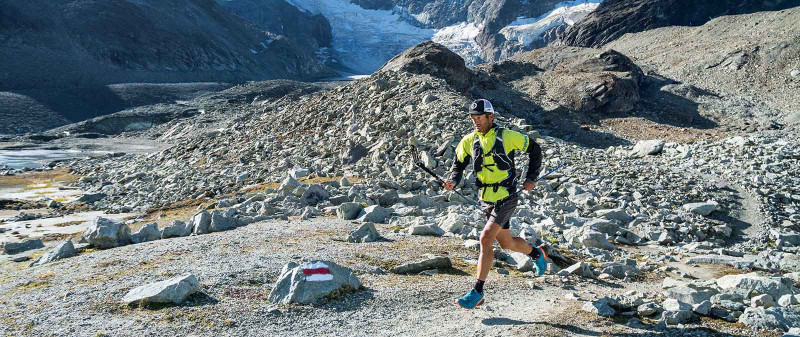
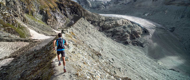
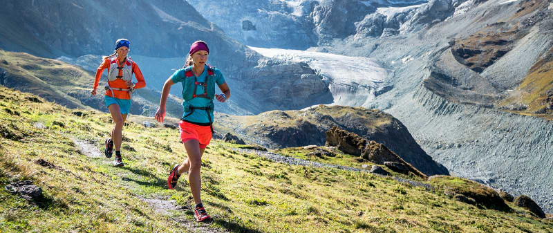
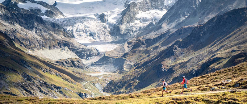
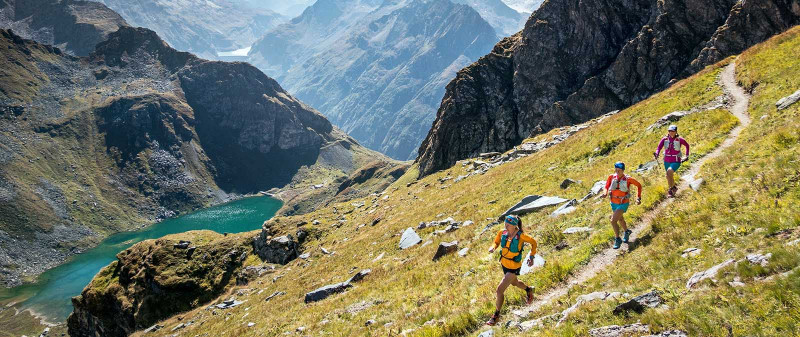
The Via Valais is a multi-day tour that stretches for 225 kilometers with more than 14,000 meters of climbing. Along the way, it takes you through some of the most beautiful areas of the Swiss Alps and ends in sight of the majestic Matterhorn. The terrain is technical and up along the high passes and peaks sometimes very challenging. Endlessly flowing singletrack is a huge portion. The route is made for running, and the backdrop could not be more gorgeous: the highest mountains in Switzerland in sight as it snakes past huge glaciers through breathtaking and wild valleys. Your sleep in mountain huts and, if you want, each day you have the opportunity to take on an extra summit.
(30k, 1783m+ / 1178m-) The second half of the stage goes from hut to hut without taking you down directly into the valleys. A high traverse above the Val d'Hérémence leads to the Grande Dixence, the highest gravity dam in the world. From there, the route is primarily flat along the barrier lake La de Dix. After that, it leads over the Pas de Chèvre into the Val d’Arolla to Cabane Aiguille Rouge.
STAGE 3: Cabane Aiguille Rouge - Cabane Becs de Bosson
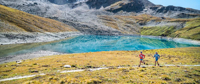
(25k, 2220m+ / 2052m-) From the Cabane Aiguille Rouge hut, you go directly downhill where you first run along an expansive moonscape and pass by the Lac Blue. Our path then leads us over an uphill traverse high over the valley to the next descent. Through the Lärchenwald we end up in the small village of Evolène in the Val d’Hérens. From Evolène you head along another steep 1,600 meters up to the Pas de Lovégno and farther to the Cabane des Becs de Bosson.
(17k, 868m+ / 1025m-) A quick descent leads you from the pastel-colored countryside of the Becs de Bosson to the Lac de Lona. After a short climb, the colors in the landscape change completely. Warm earth tones make way for the Alpine gray in the mountains and the glacier landscape of the Val de Moiry. The blue of the small lake looks totally surreal. Our stage today ends with the climb across the moraine at the Cabane de Moiry refuge at 2,825 meters. The stage is somewhat shorter and has less vert as the other stages. So you have a little more time to relax, and from the terrace we could enjoy the view to the surrounding mountains and 4000ers.
STAGE 4: Cabane Becs de Bosson - Cabane de Moiry
(17k, 868m+ / 1025m-) A quick descent leads you from the pastel-colored countryside of the Becs de Bosson to the Lac de Lona. After a short climb, the colors in the landscape change completely. Warm earth tones make way for the Alpine gray in the mountains and the glacier landscape of the Val de Moiry. The blue of the small lake looks totally surreal. Our stage today ends with the climb across the moraine at the Cabane de Moiry refuge at 2,825 meters. The stage is somewhat shorter and has less vert as the other stages. So you have a little more time to relax, and from the terrace we could enjoy the view to the surrounding mountains and 4000ers
STAGE 5: Cabane de Moiry - Zinal
(24k, 1064m+ / 2215m-) Stage 5 offers one of the most diverse days of the Via Valais – especially if you take a little side excursion to Pigne de la Lá. If you want to climb the peak, then you’ll rack up another 600 meters, but there you’ll be doing more scrambling than running. If you feel comfortable with easy scrambling along a ridge or on exposed terrain the this little side route is totally worth it. On the way back, you again come past the hut and can stop in for a mid-morning snack. On the descent from Canabe de Moiry to Zinal, one runs along the lake above it before you climb up 500 meters to the Col de Sorbois. After a traverse it heads down to Zinal.
STAGE 6: Zinal - Turtmann Hut
(19k, 1687m+ / 841m-) After Zinal, you first go past a small village. From Zinal, we follow the famous downhill of the Sierre-Zinal race course for a few kilometers before we climb up to the Forcletta Pass. We cross the Röstigraben and run along a trail lined with wild beeries down to Turtmannsee lake. Then we head up to Turtmann Huy where we set up our next night’s lodging.
STAGE 7: Turtmann Hut - Randa
(18km 1376m+ / 2453m-) The crowning glory of Via Valais! It is a long, tough day that takes us up to 3,610 meters. From the hut, we quickly find ourselves again in a barren, alpine landscape. The detour to Barrhorn is absolutely worth the extra 90 minutes. From the peak, we take the same way back til we reach Schölljoch. Now we are at the crux of the Via Valais. The descent from the pass down to the glacier is exposed and secured with ropes and a ladder. As soon as you have Schölljoch behind you, you are facing a 2,000-meter descent to Randa where it surprisingly here and then also goes uphill again.
STAGE 8: Randa - Mountain Lodge Ze Seewjinu
(25k, 2025m+ / 1171m-) On this stage a lot of vert awaits us. After you have the climb to Europaweg behind you the terrain is a little less steep. Simple running is beautiful and a relaxing counter to the adventure of the previous stage. You fly along the trail, ticking off kilometer after kilometer. The first view in close proximity of the majestic Matterhorn really does something to you. Before you know it, you can stick your feet in the refreshing water of the Grünsee and, after that, you come to a stop at the Mountain Lodge Ze Seewjinu above Zermatt.
STAGE 9: Mountain Lodge Ze Seewjinu - Zermatt
(27k, 1254m+ / 1942m-) We have a very good reason not to run directly to Zermatt: The final stage high above Zermatt is one of our favorite runs from the book Trail Running Schweiz: 30 Unglaubliche Läufe (Trail Running Switzerland: 30 Unbelievable Runs). After an enjoyable run to Zmutt, a small well-preserved hamlet with stupendous coffee and snacks, we start a 800-meter climb to the upper Matterhorn Panorama Trail. The path to the Trift Hotel is one of the most beautiful trails in all of Valais. In the Trift Hotel, one definitely has to take a short break and enjoy a homemade iced tea. From the hotel, one can run directly down to Zermatt. If you haven’t had enough yet and don’t want the Via Valais to come to an end can take on a bonus peak with the Mettelhorn.
Comments about Via Valais
The start: Stage 1, Verbier to Cabane d'Essertze: “We leave Verbier along the Bisse de Levron and have a smooth start. We actually started our planning months earlier, with our first idea, studying maps, and of course considering fully all of the possible obstacles or problems. But now we are finally running. Our plan is dependent on some many things. Will we have good weather? Will our legs play along and, in particular, will the trails actually go where we think? After an easy warmup along the water, it gets a little more wild. The first days offer up a sampling of what we can expect on the tour: Singletrack, steep climbs and huge snow-covered peaks.” – Kim Strom
The crowning glory: Stage 9, Mountain Lodge Ze Seewjinu to Zermatt: “At the end of our tour, we enjoy one last iced tea in the Trift Hotel before we run down to Zermatt. Inside of 20 minutes we are back in civilization. From the trail, you drop down directly onto the main street with all of its teeming restaurants, and numerous shops and people with freshly coiffed hair and clean clothes. I look down at my grimy feet and would prefer to immediately go back and start all over again. But first there is a huge burger to be had!” – Kirra Balmanno (Australian trail runner and Via Valais team member)
Further information: https://elevation.alpsinsight.com/via-valais/
About Alpsinsight
The ALPSinsight Team consists of professional mountain sport content providers Dan and Janine Patitucci plus Kim Strom. Since 1997, PatitucciPhoto has been producing professional mountain sport content for global commercial & editorial clients: The trio launched ALPSinsight to share their enthusiasm about their home mountains, the Swiss Alps. In 2017, the team produced the Run the Alps Switzerland guidebook and the portal Elevation: The Alps Trail & Peak Running Resource. As the leading trail running specialists in Switzerland they created the Via Valais.
Etna Speed Rush
Read more
Ski Touring Crete
An experience report about an exotic ski touring trip to Crete, endless snow-covered expanse in the Lefka Ori mountains and Greek hospitality.
Read more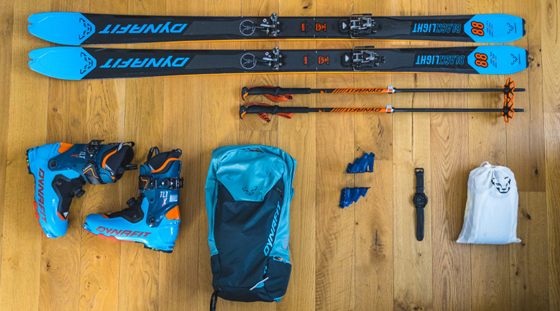
What's inside my skimo pack?
Are you planning a ski tour? Our packing list will help you optimize your preparation. From the right equipment to key essentials, you will find everything you need for the perfect ski tour.
Read more

